NISAR launched July 30, 2025, and has been successfully collecting data through its Commissioning phase and into the Science phase. The calibration-validation process is underway, and a selection of pre-calibration data generated from NISAR acquisitions is available to the public.
NISAR Pre-Calibration Data: February 2026
A selection of pre-calibration NISAR Level-1 to Level-3 L-band products are available through the ASF DAAC. This large volume of global data allows users to develop workflows to access the data and metadata for each product type, to become familiar with the characteristics of the L-band products, and to begin working with the data in a substantive way.
The user community can prepare for managing NISAR’s large data volumes and refine their processing pipelines in anticipation of full global production and release of calibrated data in July 2026. Users will find a rich and unprecedented collection of polarimetric and interferometric products to explore, with fine resolution, accurate geolocation, and full of bio/geophysical features.
Product Availability
The February 2026 release of NISAR pre-calibration data includes a global dataset, representative of the final product distribution of all NISAR products. All Level-1 to Level-3 L-band product types are available.
This release includes data acquired between October 17, 2025 and January 20, 2026. This includes up to 8 acquisitions per track (both ascending and descending). Figure 1 displays the spatial extent of the data included in this release. For a more detailed acquisition map, see the interactive NISAR February 2026 Released Data map.

Figure 1:Spatial distribution of the archived pre-calibration NISAR data products, highlighted in green, included in the February 2026 data release.
Basemap credits: Esri, TomTom, Garmin, FAO, NOAA, USGS, (c) OpenStreetMap contributors, and the GIS User Community.
Known Issues
A new instrument producing global data products for the first time will necessitate optimization of the products over time. In addition, the NISAR project is still in the calibration and validation phase, and these products are not yet fully calibrated. Nonetheless, the data are expected to be of sufficient quality that most users will benefit from an early look at the products.
See Pre-Calibration Product Known Issues for a list of known issues reported for the current data release.
Fully calibrated and algorithmically improved global products are expected to be available starting July 2026.
Data Release Timeline
NISAR has continually collected L-band data over nearly all global land mass since August 2025. Figure 2 shows the spatial extent of the collected data. The NISAR Reference Observation Plan provides a more detailed, interactive map of NISAR data acquisitions.
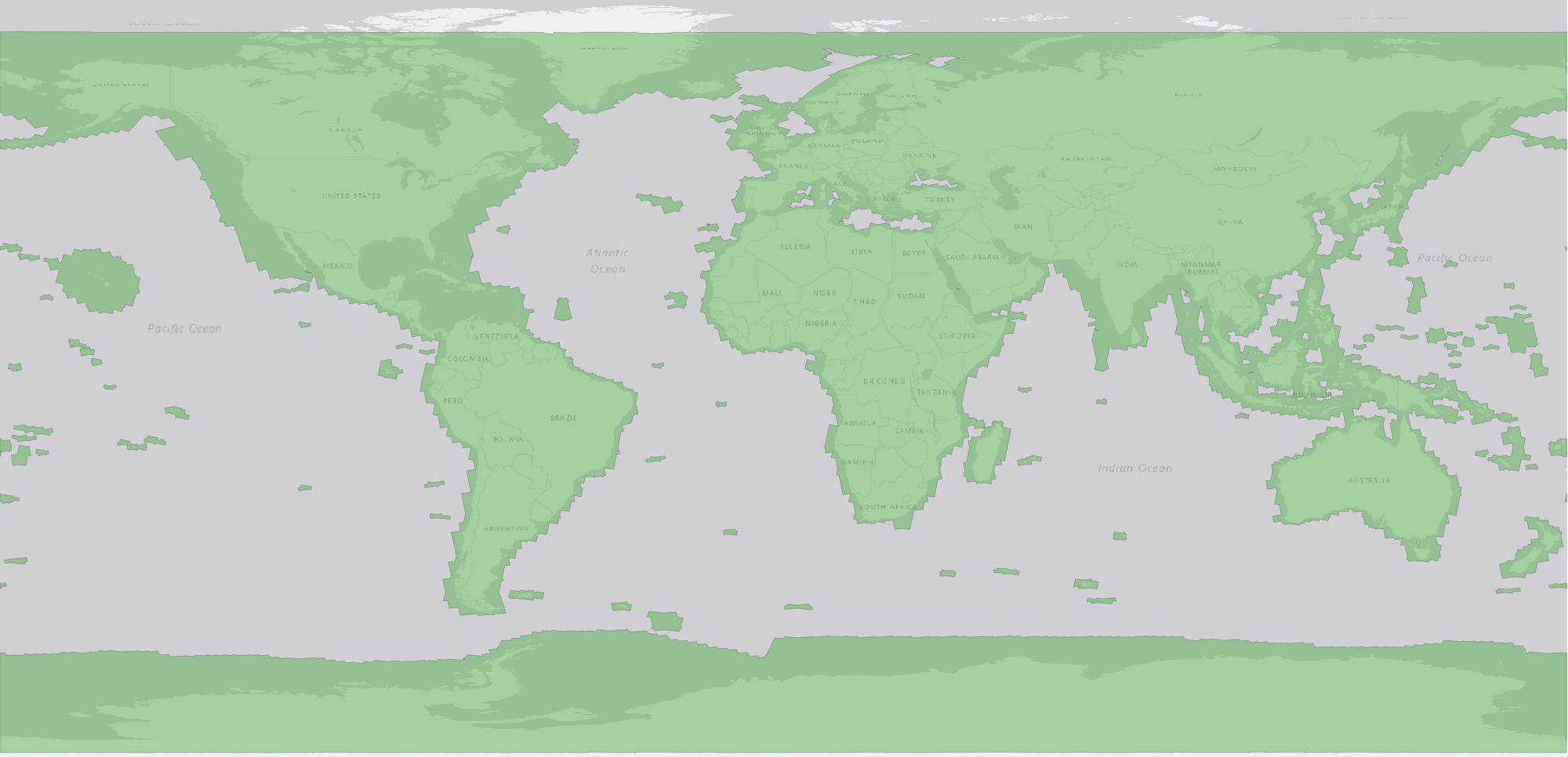
Figure 2:Spatial extent of NISAR L-band data collection, highlighted in green. Basemap credits: Esri, TomTom, Garmin, FAO, NOAA, USGS, (c) OpenStreetMap contributors, and the GIS User Community.
The NISAR project will generate Level 0-3 data products from all L-band data acquired since September 23, 2025. All L-band data products will be available to the public through the Alaska Satellite Facility.
The nominal data release timeline as of June 2026 is described below.
Jan 2026: Sample products
An initial release of 25 pre-calibration sample data products were made available on January 23, 2026. This release included one or more products of each of the nine Level 1-3 product types.
Feb 2026: Pre-calibration products
A larger volume of pre-calibration global data products were made available on February 27, 2026. This release included over 100,000 Level 1-3 products totaling over 500 TB of science data.
Jul 2026: Calibrated forward processing
After the calibration phase concludes and planned software improvements are completed, the NISAR project will begin forward processing of newly-acquired data. Forward processing is targeted to begin in July 2026.
Fully-calibrated Level 0-3 products will be continuously generated from all data acquired from the start of forward processing into the future. This includes data for all areas shown in Figure 2 and in the NISAR Reference Observation Plan.
New data will be continuously published to ASF and made publicly available. Level 1-3 products will have a nominal latency of 36-72 hours from data acquisition to availability. This will also include the initial public release of L0B RRSD products, which will have a nominal latency of 1-12 hours.
Q3-4 2026: Calibrated back processing
After the start of forward processing, the NISAR project will produce calibrated Level 0-3 products from the global backlog of all data collected September 23, 2025 through the start of forward processing in July 2026. This processing will complete before the end of the calendar year. Data products will be continually published to ASF and made publicly available as they are generated over the course of the processing campaign.
The calibrated products generated by this processing campaign will supercede any pre-calibration products delivered in the January 2026 and February 2026 releases.