Harmony Services for NISAR
Harmony is Earthdata’s data transformation service for customizing NASA datasets. It is seamlessly integrated into the Earthdata Search platform, but users can also leverage the Harmony APIs or the Harmony-py Python library to interact with the data programmatically.
ASF is working with the Harmony team to develop subsetting functionality, starting with a service that extracts individual datasets from NISAR HDF5 products and exports them as GeoTIFFs.
Refer to the Tools and Services Roadmap to see the development plan for additional Harmony services supporting NISAR.
Dataset Extraction Service
Users can use Harmony to extract individual datasets as GeoTIFFs from NISAR HDF5 files for the following products:
Geocoded Polarimetric Covariance (GCOV)
Geocoded Unwrapped Interferogram (GUNW)
Geocoded Pixel Offsets (GOFF)
Soil Moisture (SME2)
This service extracts two-dimensional datasets from the /science/LSAR/$product-type/grids/ group as stand-alone GeoTIFFs. This is particularly useful for those users only interested in one or two layers in a product.
Because the HDF5 files are more compressed, users interested in several layers will be better served by downloading the full HD5 file, as they are more efficient to download than extracted GeoTIFF files.
Extract Datasets in Earthdata Search
Harmony services are available directly in Earthdata Search, which is a map-based web browser interface for data search and access. This makes it easy to find NISAR products for your area and time period of interest and extract just the datasets of interest from the HDF5 file. Each selected dataset is output as a GeoTIFF file.
Search for one of the supported product types in Earthdata Search and select the desired collection.
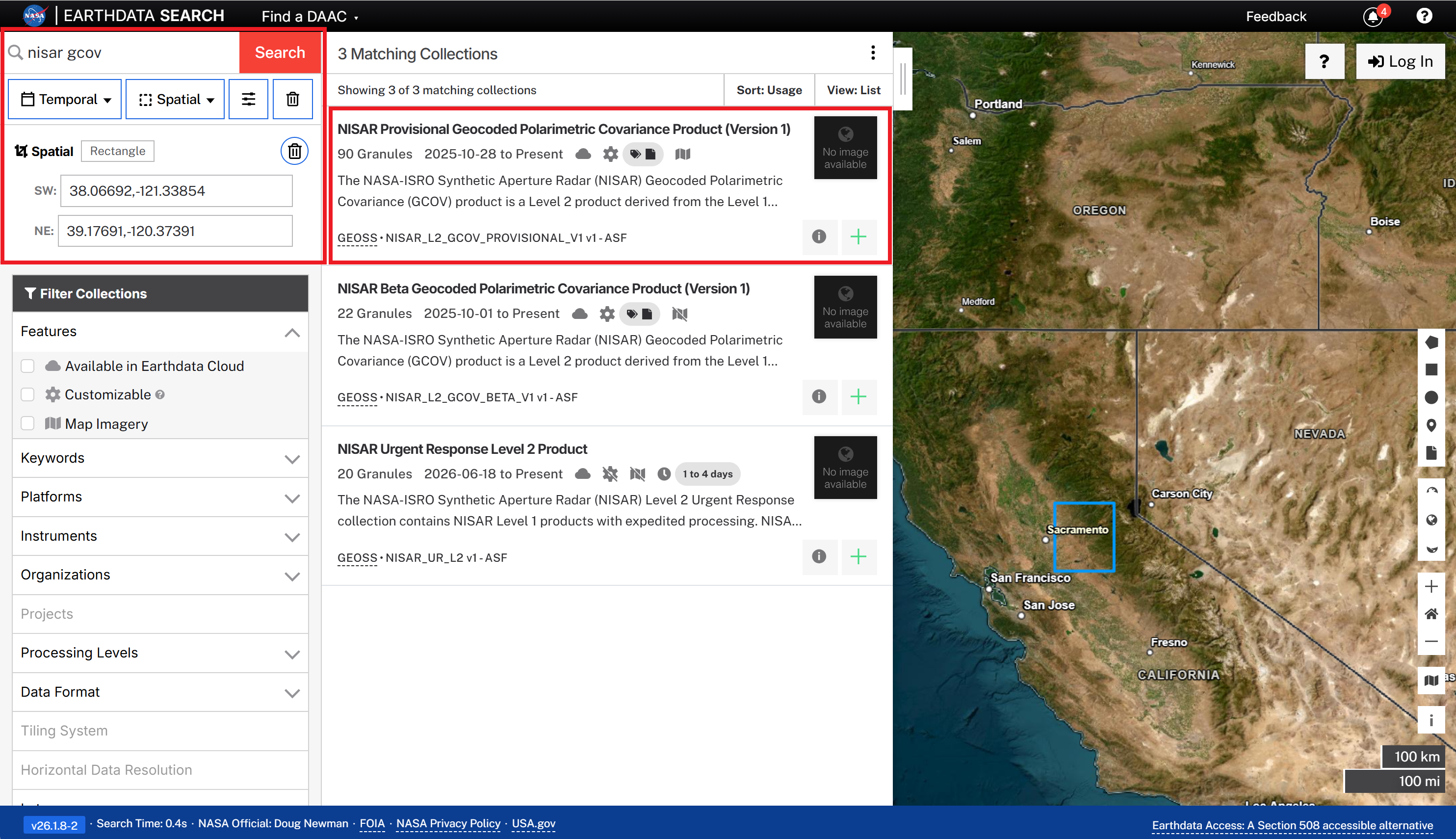
Figure 1:Search for supported product type collections in Earthdata Search and select the desired collection.
Add one or more granules to a project by clicking the green + icon for each item of interest.
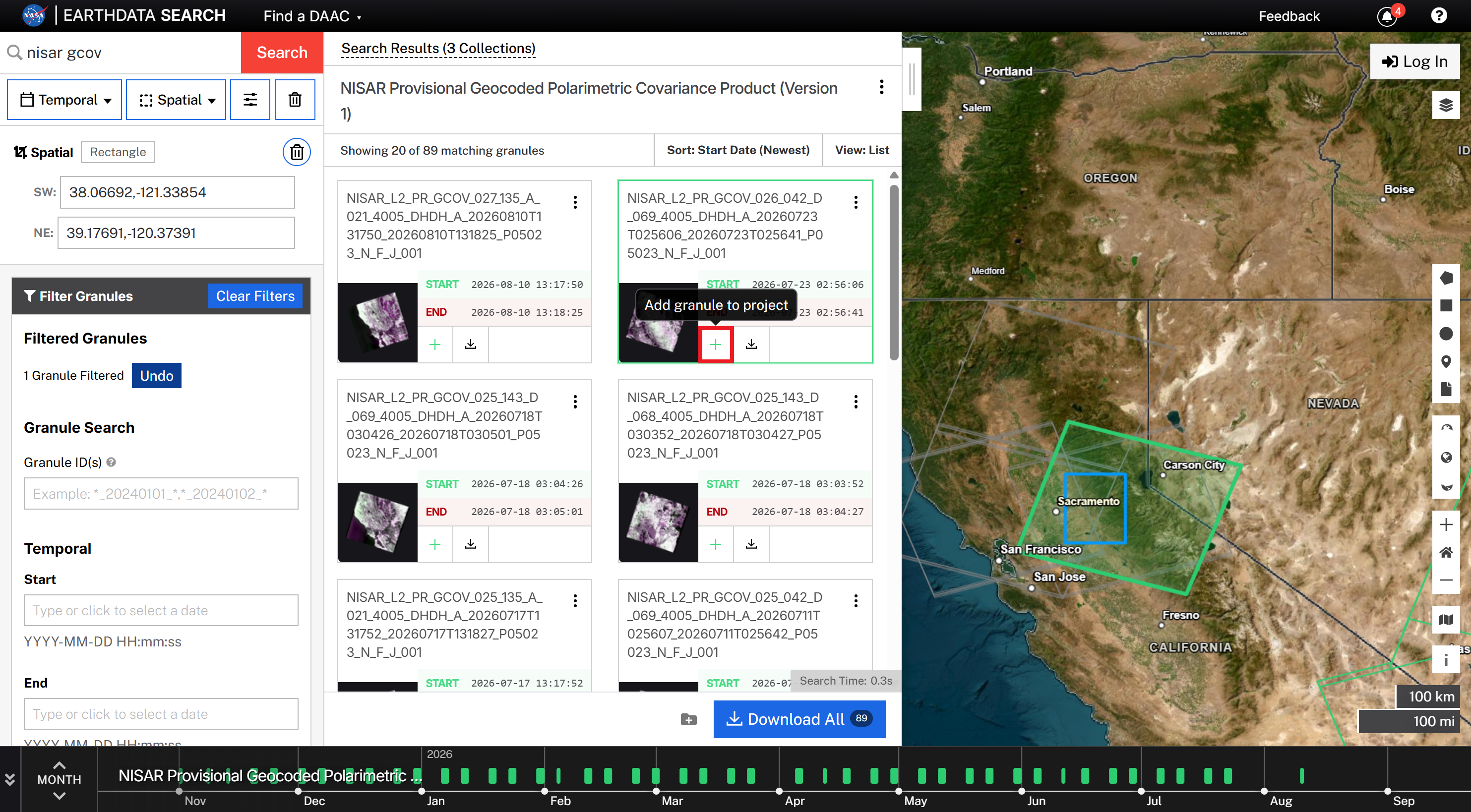
Figure 2:Click the green + icon for a granule of interest to add it to your project.
Click the My Project button to view the list of granules you’ve added.
You will need to log in with your Earthdata Login credentials if you have not already done so.
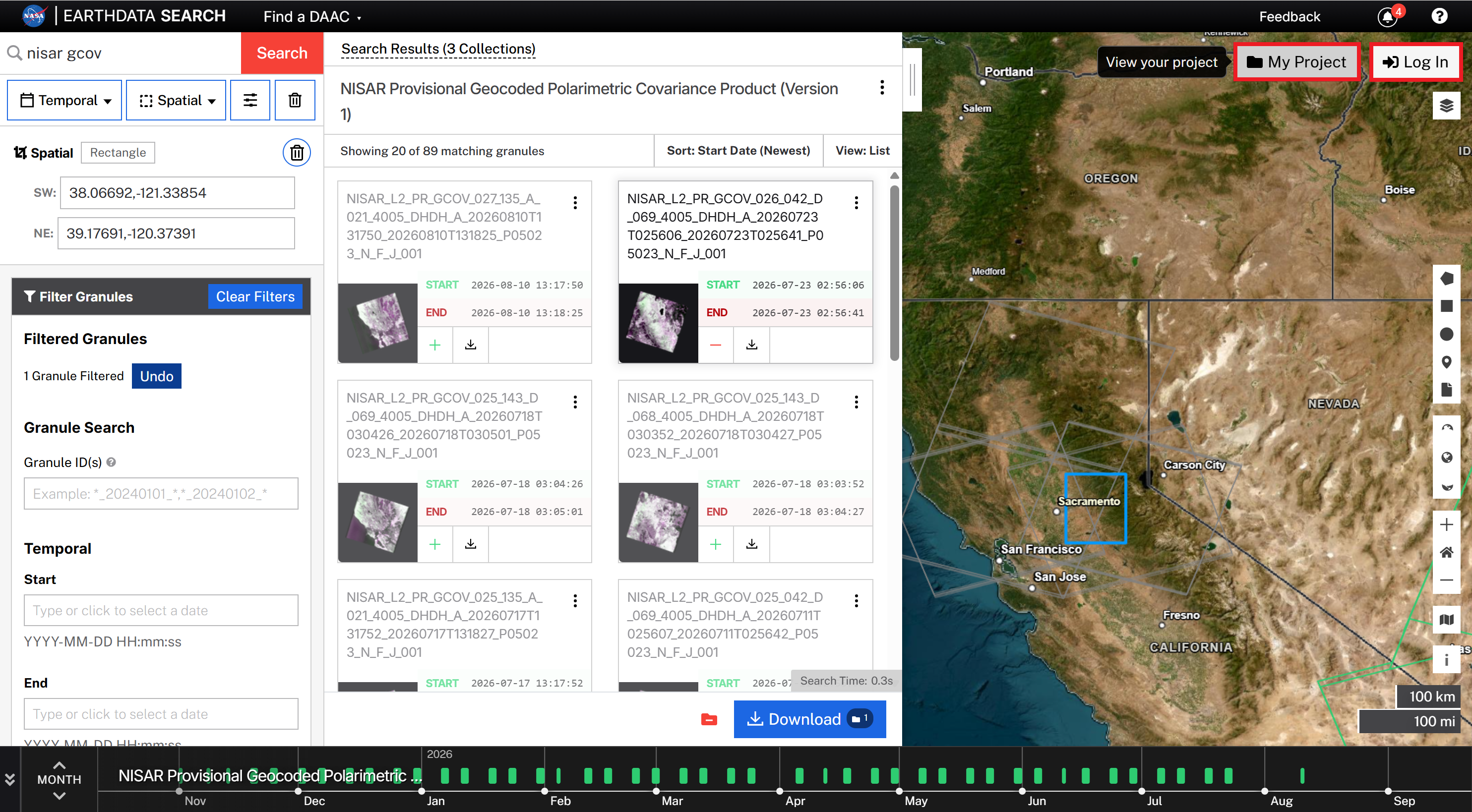
Figure 3:Click the My Project button to view the list of granules you’ve added.
Select the Customize Download option, then click the Edit Variables button.
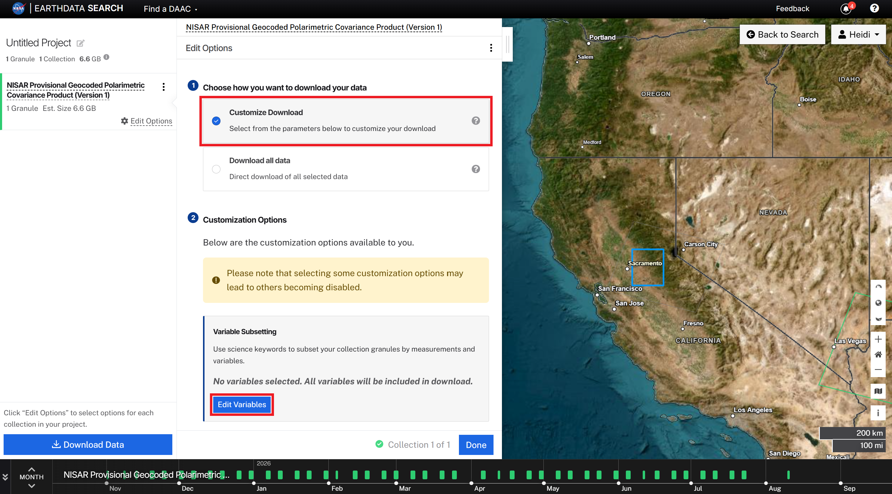
Figure 4:Select the Customize Download option, then click the Edit Variables button.
If you add datasets for multiple collections to the same project, each collection will be listed in the left panel. You can switch collections by clicking the Edit Options link for the desired collection.
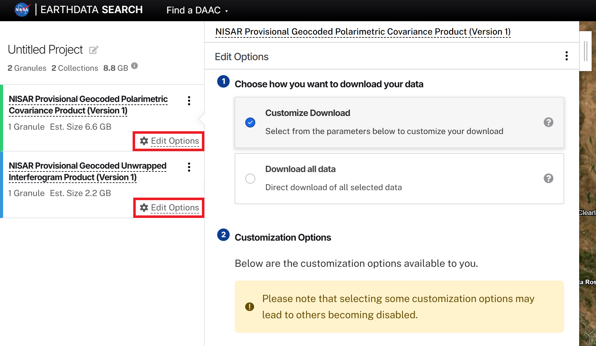
Figure 5:When multiple collections are included in the project, click the Edit Options link for each collection to set the variables to extract.
Expand the HDF5 group structure by clicking on the directory icons to see their contents. Select the individual datasets to extract, then click the Download Data button.
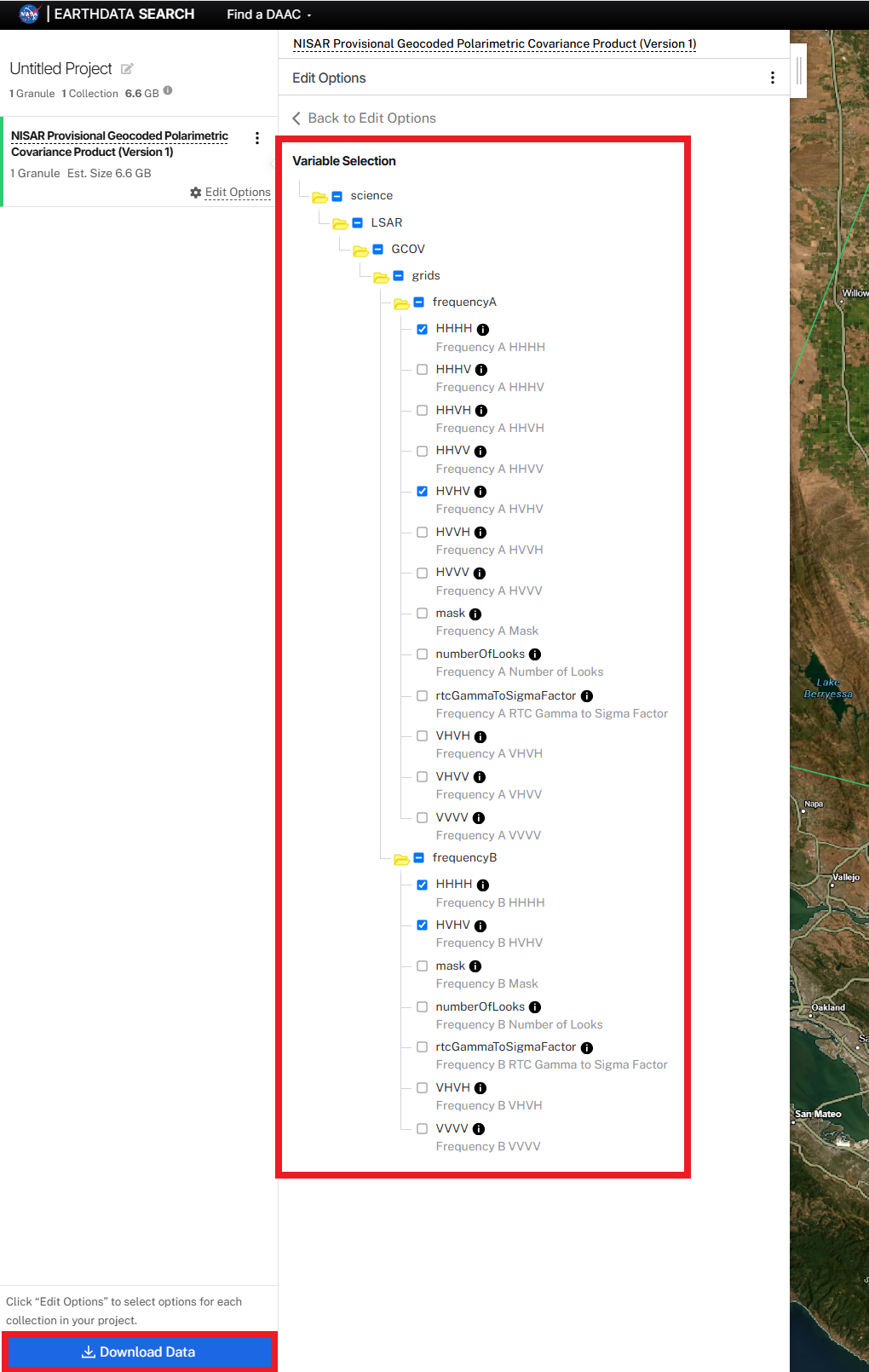
Figure 6:Expand the directory structure and select the datasets to be extracted to GeoTIFF format, then click the Download Data button.
Not all products will contain all the listed variables. This list includes all possible variables that may be present in a product of that type. As long as at least one of the selected datasets is available in the product, the Harmony job will run.
GeoTIFFs will be generated for any selected variables that are present in the granule, and any datasets that are not present will be ignored.
If you do not see a download link for a variable you selected, refer to the file naming convention to determine which polarizations and frequencies would be expected for that product.
If multiple collections are included in the Project, you will need to define the download options for each one. You can either:
Click the Edit Options link for each collection, as illustrated in Figure 5.
Click the Back to Edit Options link at the top of the panel once you have made your variable selections and click the Next button to progress through each collection.
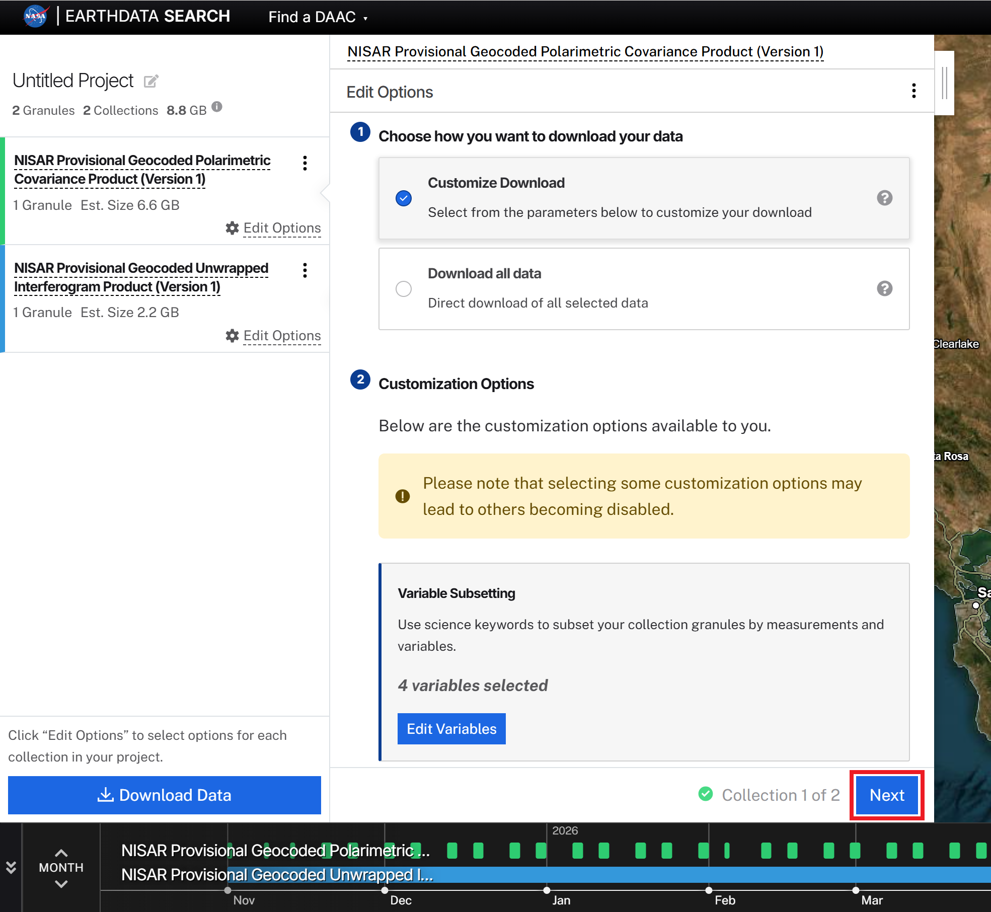
Figure 7:To set download options when multiple collections are included in the project, click the Next button at the bottom of the Edit Options panel to move to the next collection.
The Download Data button will launch the Harmony jobs for all collections in the project that have extraction options defined.
Harmony will process your extraction request and indicate its progress on the status page. You may need to refresh the status page to see updated progress.
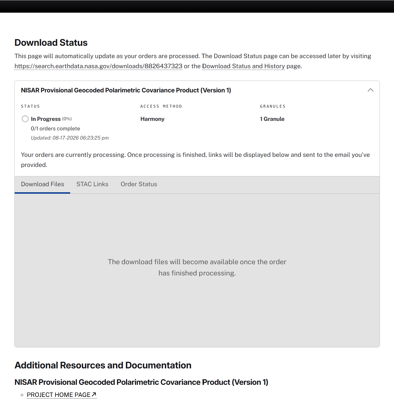
Figure 8:Once you click the Download Data button, the Harmony Status page will open and indicate progress.
Once the extraction process is complete, the download links for the individual GeoTIFFs will be displayed. Click each link to download the products through the web browser, or click the Download Files button to leverage the Earthdata bulk download app.
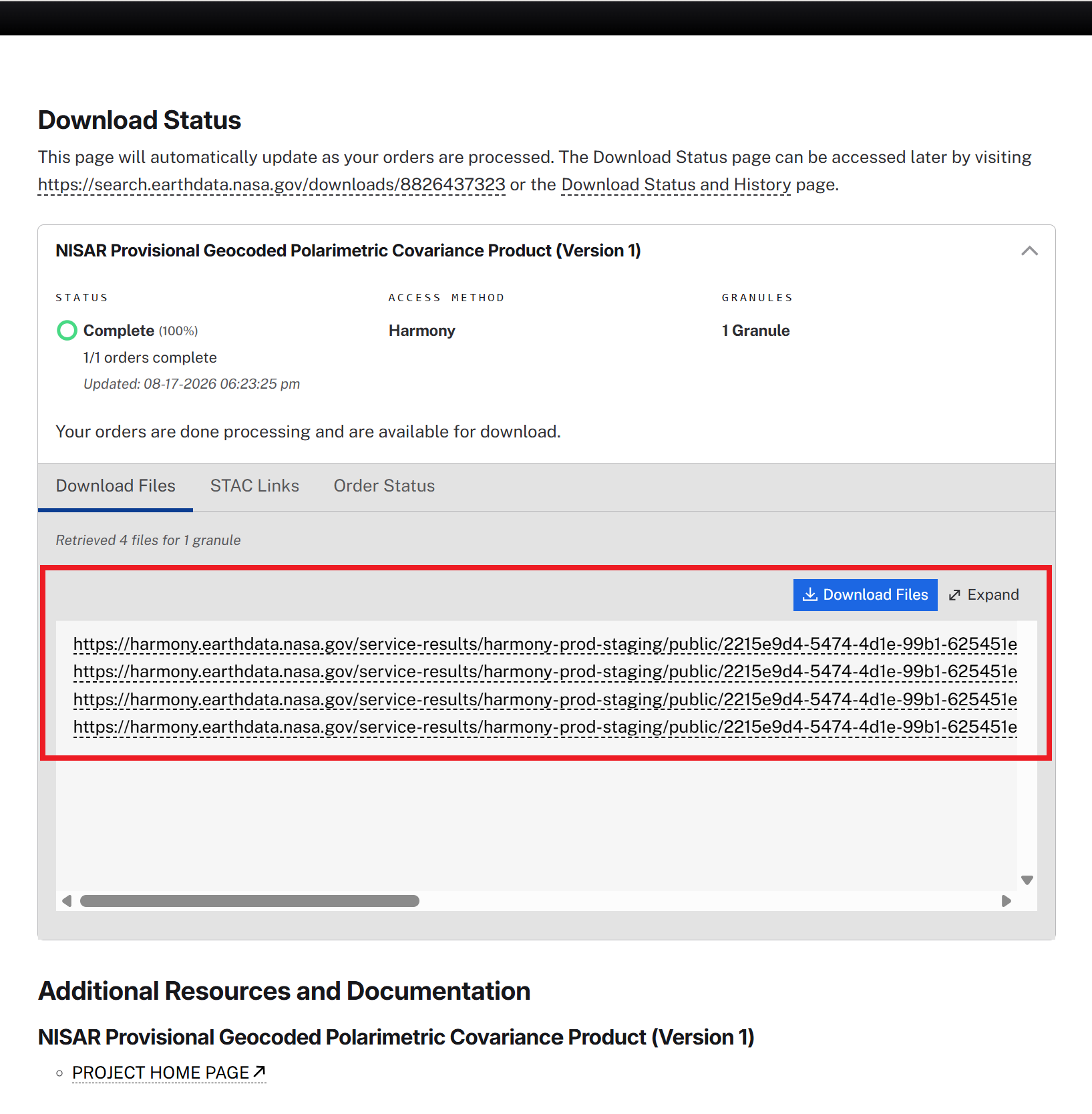
Figure 9:Once the extraction process is complete, the Harmony Status page will display the download links for the extracted GeoTIFFs.